
Just in case you are not aware. There are some high-resolution DEMs, Digital Elevation Models, you can download from Flightsim.to, which can largely improve the rendering of terrains in their respective regions.
Not sure if you want it? Here are two sets of photos comparing the terrain appearance of LSGR Reichenback Airport, which I randomly picked, in Switzerland with and without using the 20m DEM from Troglodytus.


In photo set 1, with DEM, the taxiway and runway intersection now has a gradient; the roads and other objects on the hill sides seem more rational; and the edges and shapes of the mountains in the background are more prominent as well. Continue reading
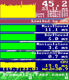 In a “conversation” I had with Michael Basler in Germany earlier last month, he said that his fps were literally cut by 50% when he shifted a pop-out screen to a touch monitor connected to the main computer.
 running (meaning the aircraft isn’t started from cold and dark), its VOR2 needle is always deflected to the left?